
2.2: Conservation Practices for Shorelines, Streams, and Wetlands
- Page ID
- 21311
Abbreviations
PDF – Portable Document Format
NC – North Carolina
NRCS – Natural Resources Conservation Service
SWCS – Soil and Water Conservation Society
URL – Uniform Resource Locator
US – United States
USACE – US Army Corps of Engineers
USDA – US Department of Agriculture
USFWS – US Fish and Wildlife Service
Streambank, Shoreline, and Coastal Protection
Broome, S. 2015. Restoration and Management of Coastal Dune Vegetation. Raleigh, NC: NC State University. https://content.ces.ncsu.edu/restoration-and-management-of-coastal-dune-vegetation.
Coastal dunes perform many functions, protecting low-lying areas, acting as barriers against storm surge and waves, and providing habitat to migratory birds and other animals. This extension bulletin from North Carolina State University describes these functions of beach-dune systems. It focuses primarily on beach dune restoration, including grasses, fertilization, construction, and protection.
National Research Council. 2007. Chapter 3 Methods for Addressing Erosion. In Mitigating Shore Erosion Along Sheltered Coasts, 44–77. Washington, D.C.: National Academies Press. https://www.nap.edu/read/11764/chapter/5.
This chapter from Mitigating Shore Erosion AlongSheltered Coasts focuses on strategies for limiting erosion on shorelines. The strategies can be grouped into soft and hard methods of conservation. Soft methods described in this chapter include managing land use, vegetation, marshland, seagrass, and vegetated dunes. Hardened structures described include bulkheads, seawalls, revetments, breakwalls, and sills. Strategies to trap or add sand are also discussed in detail, including beach nourishment, groins, and breakwaters, among others. The chapter then provides design elements and criteria for implementing conservation practices on shores and coasts.
USDA NRCS. 1996. Chapter 16 Streambank and Shoreline Protection. In Engineering Field Handbook, 143. Washington, D.C.: USDA NRCS. https://directives.sc.egov.usda.gov/viewerFS.aspx?hid=21429
Chapter 16 of the Engineering Field Handbook from the USDA NRCS provides technical details for streambank and shoreline protection practices. This chapter should help engineers determine appropriate measures to minimize streambank and shoreline erosion.
USDA NRCS. 2010. Streambank and Shoreline Protection. Conservation Practice Standard 580. 4. Washington, D.C.: USDA. https://www.nrcs.usda.gov/Internet/FSE_DOCUMENTS/stelprdb1046931.pdf.
This conservation practice standard overview defines streambank and shoreline protection as applying structural or vegetative measures to protect and stabilize banks of streams, lakes, estuaries, or excavated channels. This standard includes the purpose of the practice, conditions where it applies, criteria, considerations, plans and specifications, and operation and maintenance. The URL leads to a direct download of a PDF.
USDA NRCS. 2012. Streambank and Shoreline Protection. Conservation Practice Standard Overview 580. 1. Washington, D.C.: USDA. https://www.nrcs.usda.gov/Internet/FSE_DOCUMENTS/stelprdb1255166.pdf.
This document defines streambank and shoreline protection as applying structural or vegetative measures that protect and stabilize banks of streams, lakes, estuaries, or excavated channels. The USDA NRCS provides a general overview of the practice and closes by listing conservation practices commonly associated with streambank and shoreline protection. Those practices include riparian forest buffers, riparian herbaceous buffers, fences, channel bed stabilization, and open channels.
Stream Conservation
Allen, H. H., and J. R. Leech. 1997. Bioengineering for Streambank Erosion Control. Report 1 – Guidelines. 105. Vicksburg, MS: USACE, Waterways Experiment Station. www.dtic.mil/docs/citations/ADA326294.
This report from the USACE outlines bioengineering of streams to prevent streambank erosion. Bioengineering streams requires using living organisms like trees and other plantings along streams to protect the stream from erosion instead of using rip rap and other expensive, hard engineering practices. The report synthesizes bioengineering applications and provides preliminary planning and design guidelines for eroded streambanks. This document can be used as a guide to bioengineering projects but should not be used as a cookbook. The guidelines include the scope of the practices and details on planning, hard structures, and bioengineering, bioengineering by zones, bioengineering treatments, and velocities. It also outlines plant acquisition, handling, and timing of planting, as well as information about monitoring, aftercare, and costs.
EPA. 2015, September 15. Hydromodification and Habitat Alteration: National Management Measures. https://www.epa.gov/nps/hydromodification-and-habitat-alteration-national-management-measures.
The EPA developed this document to guide implementation of hydromodification projects to reduce surface and groundwater pollution from nonpoint sources.
EPA Office of Water, O. 2016, September 14. Stream Corridor Restoration Tools. https://www.epa.gov/watershedacademy/stream-corridor-restoration-tools.
This web page provides an index to the eleven sections of the Watershed Technology Electronic Catalog. The Watershed Technology Electronic Catalog contains media and text on 150 watershed management practices. This resource gives watershed managers and restoration practitioners a starting point for restoration design projects. These design products should be modified to fit individual projects by skilled professionals after in depth site analysis and planning.
Iowa Department of Natural Resources, and USDA NRCS. 2006. How to Control Streambank Erosion. www.iowadnr.gov/portals/idnr/uploads/water/stormwater/streambankmanual.pdf
This manual from the Iowa Department of Natural Resources, published in cooperation with the USDA NRCS, addresses controlling streambank erosion. It describes in detail several control methods that are most applicable in Iowa and other midwestern states. The manual primarily focuses on bioengineering methods and is not a technical manual but a planning aid for streambank protection projects. The URL leads a direct download of a PDF.
Channel Bed Stabilization
USDA NRCS. 2015. Channel Bed Stabilization. Conservation Practice Standard 584. 3. Washington, D.C.: USDA. https://www.nrcs.usda.gov/wps/PA_NRCSConsumption/download?cid=stelprdb1255169&ext=pdf.
In this conservation practice standard, the USDA NRCS describes how to stabilize stream channel beds. The standard includes conditions where the practice could be applied and what should be considered when attempting streambed stabilization. It also includes details for plans and specifications and operations and maintenance. The URL leads to a direct download of a PDF.
USDA NRCS. 2015. Channel Bed Stabilization. Conservation Practice Standard Overview 584. Practice Introduction. 1. Washington, D.C.: USDA. https://www.nrcs.usda.gov/wps/PA_NRCSConsumption/download?cid=nrcs143_026241&ext=pdf.
This overview from the USDA NRCS provides a brief summary of channel bed stabilization, describing how and under what circumstances channel beds should be altered for stabilization, as well including a few parameters and precautions. It has a list of conservation practices commonly associated with channel bed stabilization, including streambank and shoreline protection, clearing and snagging, and open channel. The URL leads to a direct download of a PDF.
Filter Strips
Grimser, M. E., A. T. O’Geen, and D. Lewis. 2006. Vegetative Filter Strips for Nonpoint Source Pollution Control in Agriculture. 7. Oakland, CA: University of California Division of Agriculture and Natural Resources. https://anrcatalog.ucanr.edu/Details.aspx?itemNo=8195#FullDescription.
This extension bulletin from the University of California provides a general overview of vegetative filter strips. Design considerations are described, and examples of pollutant removal efficiency are provided in table format. An example design for an irrigated farming operation are provided. This bulletin caters to horticultural crop producers, farm managers, and practitioners.
Smyth, A., R. Muñoz-Carpena, and Y. Li. 2015. Vegetative Filter Strips–A Best Management Practice for Controlling Nonpoint Source Pollution. Extension Bulletin SL432. 5. Gainesville, FL: University of Florida Institute of Food and Agriculture Sciences Extension. edis.ifas.ufl.edu/ss646.
This extension publication from the University of Florida gives a concise description of vegetative filter strips and provides an overview of the primary functions, design factors, and effectiveness for removing emerging pollutants. A number of figures help convey the main points presented in the bulletin.
USDA NRCS. 2016b. Filter Strips. Conservation Practice Standard 393. 4. Washington, D.C.: USDA. https://www.nrcs.usda.gov/Internet/FSE_DOCUMENTS/stelprdb1241319.pdf.
This conservation standard practice defines filter strips as an area of vegetation established for removing organic material, sediment, and other pollutants from wastewater and runoff. The standard includes information on the purpose of filter strips, conditions where the practice applies, criteria, considerations, plans, and specifications, as well as information on operation and maintenance. The URL leads to a direct download of a PDF.
USDA NRCS. 2016a. Filter Strips. Conservation Practice Standard Overview 393. 1. Washington, D.C.: USDA. https://www.nrcs.usda.gov/wps/PA_NRCSConsumption/download?cid=nrcs143_025826&ext=pdf.
This conservation practice standard gives an overview in which the USDA NRCS defines filter strips as an area of vegetation established for removing organic material, sediment, and other pollutants from wastewater and runoff. It includes a brief overview of filter strips and offers a list of associated conservation practices. Those include nutrient management, integrated pest management, waste recycling, and residue and tillage management. The URL leads to a direct download of a PDF.
Riparian Forest Buffer
Kansas State University Horticulture and Natural Resources. 2018, May 25. Riparian Buffers. https://hnr.k-state.edu/extension/publications/riparian-buffers.html.
This website includes a table with hyperlinks to eight extension bulletins from Kansas State University on streamside forestry and riparian forest buffers. Topics include riparian forest buffers, streambank protection, timber management, planting, and more.
Klapproth, J. C., and J. E. Johnson. 2009. Understanding the Science Behind Riparian Forest Buffers: An Overview. 4. Blacksburg, VA: Virginia Polytechnic Institute and State University. https://www.pubs.ext.vt.edu/420/420-150/420-150.html.
This extension bulletin from Virginia Polytechnic Institute and State University provides a concise overview of riparian forest buffers as an ecosystem, as well as information on the effects of these buffers on water quality, living resources, and social and community benefits. Virginia’s riparian buffer implementation plan is also summarized.
USDA NRCS. 2010. Riparian Forest Buffer. Conservation Practice Standard 391. 3. Washington, D.C.: USDA. https://www.nrcs.usda.gov/Internet/FSE_DOCUMENTS/nrcs143_026098.pdf.
This USDA NRCS conservation practice standard defines riparian forest buffers as areas with predominantly trees or shrubs adjacent to and up-slope from streams and other water bodies. The purpose of these buffers is to provide shade for water bodies to keep temperatures low, improve habitat, reduce sediment and other pollutants, and more. The standard describes where the practice applies, criteria for the practice, general considerations, plans and specifications, and operation and maintenance. The URL leads to a direct download of a PDF.
USDA NRCS. 2012. Riparian Forest Buffer. Conservation Practice Standard Overview 391. 1. Washington, D.C.: USDA. https://www.nrcs.usda.gov/Internet/FSE_DOCUMENTS/stelprdb1255022.pdf.
This USDA NRCS conservation standard overview provides a definition of riparian forest buffer, a brief description of the practice, and a list of commonly associated conservation practices. Those practices include riparian herbaceous cover, stream habitat improvement and management, streambank and shoreline protection, and tree/shrub establishment. The URL leads to a direct download of a PDF.
Virginia Department of Forestry. 2014, November 6. Riparian Forest Buffers. www.dof.virginia.gov/manage/riparian/index.htm.
This website from the Virginia Department of Forestry contains general information on riparian forest buffers, primarily for citizens of the commonwealth of Virginia. The site features many links to additional resources on riparian forest buffers, including links to each extension bulletin from Virginia Polytechnic Institute and State University in a series called “Understanding the Science Behind Riparian Forest Buffers.”
Saturated Buffers
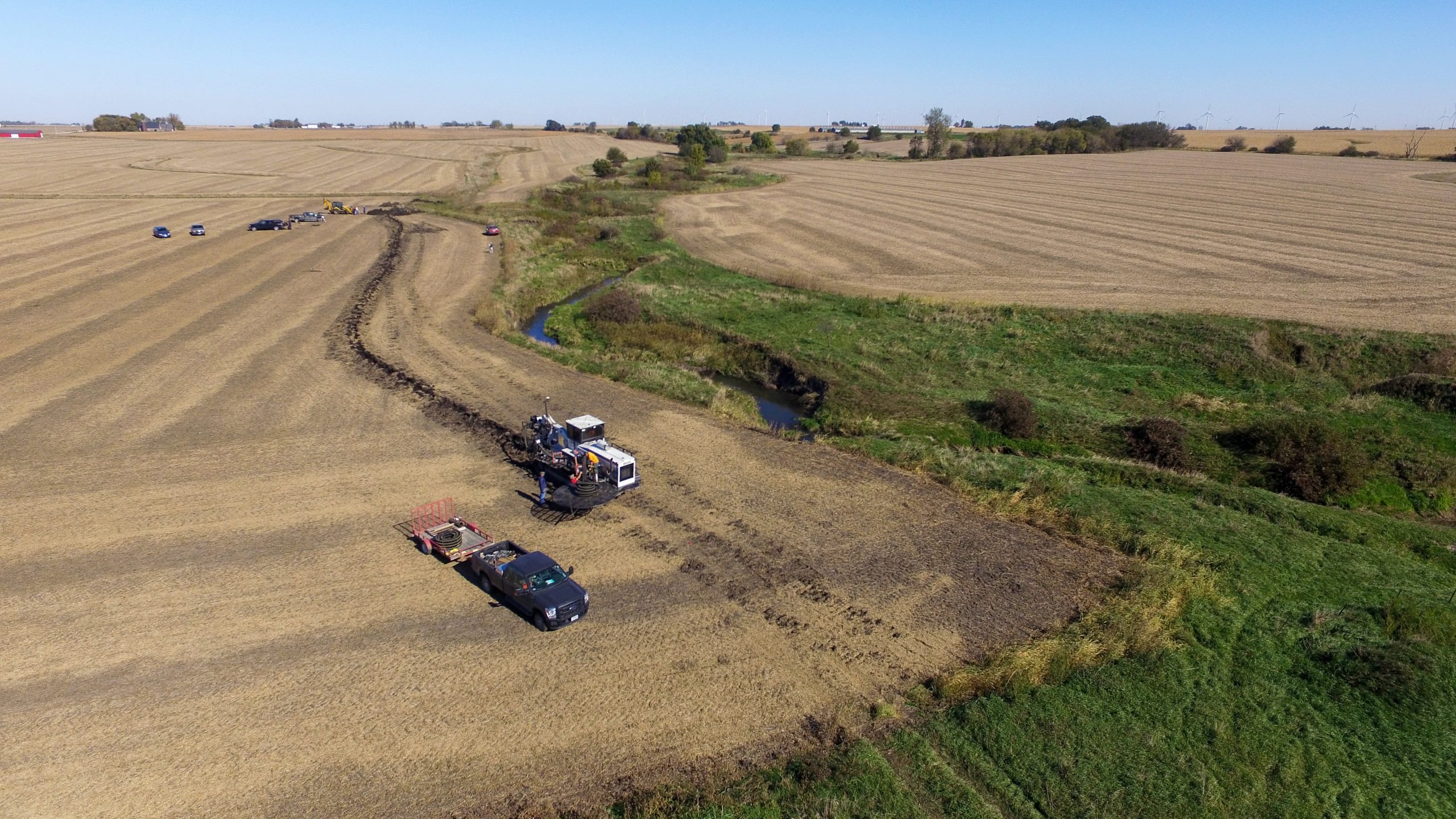
Jaynes, D., B. Reinhart, C. Hay, J. Kjaersgaard, K. Nelson, N. Utt, S. Jacquemin, and T. Isenhart. 2018. Questions and Answers About Saturated Buffers. Extension Publication ABE-160. 8. West Lafayette, IN: Purdue University. https://edustore.purdue.edu/.
This extension publication from Purdue University, Iowa State University, and others is in question-and-answer format, providing a concise, yet thorough, overview of saturated buffers. It begins with a definition of saturated buffers: an edge-of-field practice designed to remove nitrate from drainage water before it enters nearby surface waters. Examples of installations with descriptions and pictures are provided for different scenarios. Other information includes benefits to water quality, effect on crop yield; length of saturated buffers; management and vegetation considerations; costs and regulations; and appropriate sites.
SWCS. 2019. Saturated Buffer Facts. https://www.swcs.org/resources/conservation-media-library/saturated-buffer-facts.
This web page from the SWCS Conservation Media Library provides an overview of saturated buffers, a conservation practiced designed to improve water quality from agricultural drainage water. The web page includes a description of the conservation practice, a summary of benefits of the practice, and lists some economic considerations. It also includes a list of other credible sources of information on saturated buffers.
SWCS Events. 2018. Saturated Buffers: A Nutrient Removal Option for Farmers. Ankeny, IA: SWCS. vimeo.com/291573566.
This brief video from the SWCS features experts on saturated buffers: Dan Jaynes, a researcher from the ARS; Willie Ubben, a tiling contractor; and Justin Hanson, a corn and soybean farmer from Iowa. Saturated buffer installation is generally described, images are included, and the effectiveness of saturated buffers for removing nitrate from drainage water are discussed.
USDA NRCS. 2016a. Saturated Buffer. Conservation Practice Standard 604. 4. Washington, D.C.: USDA. https://www.nrcs.usda.gov/wps/PA_NRCSConsumption/download?cid=nrcseprd1051806&ext=pdf.
This conservation practice standard from the USDA NRCS defines saturated buffers as a subsurface drainage tile line used to divert and spread drainage water discharge along a vegetated area to increase soil saturation. The standard outlines where this practice is applicable, criteria for determining appropriate locations and soils, general considerations, plans and specifications, and operation and maintenance concerns. The URL leads to a direct download of a PDF.
USDA NRCS. 2016b. Saturated Buffer. Conservation Practice Standard Overview 604. 1. Washington, D.C.: USDA. https://www.nrcs.usda.gov/wps/PA_NRCSConsumption/download?cid=nrcseprd1053609&ext=pdf.
This conservation practice overview from the USDA NRCS defines saturated buffers, provides a brief overview of the practice, and lists commonly associated practices. Those practices include nutrient management and drainage management. The URL leads to a direct download of a PDF.
Stream Crossings
Higgins, S., C. Agouridis, and S. Wightman. 2011. Stream Crossings for Cattle. 7. Lexington, KY: Kentucky Cooperative Extension. http://www.ca.uky.edu/agc/pubs/aen/aen101/aen101.pdf.
This extension bulletin from Kentucky Cooperative Extension provides an overview of stream crossings for cattle. This bulletin provides livestock producers with instructions for installing stream crossings for livestock and vehicles. Many figures are provided, along with reference tables and examples.
USDA NRCS. 2017. Stream Crossing. Conservation Practice Standard 578. 6. Washington, D.C.: USDA. https://www.nrcs.usda.gov/wps/PA_NRCSConsumption/download?cid=nrcseprd1335269&ext=pdf.
This conservation practice standard from the USDA NRCS defines stream crossings as stabilized areas or structures across streams that facilitate travel for livestock, people, equipment, or vehicles. The practice improves water quality by reducing sediment, nutrient, or organic loading to streams, as well as reducing streambank and streambed erosion. The conditions suitable for the practice are described, along with criteria, general considerations, information for developing plans and specifications, and operation and maintenance considerations.
USDA NRCS. 2017. Stream Crossing. Conservation Practice Standard Overview 578. 1. Washington, D.C.: USDA. https://www.nrcs.usda.gov/wps/PA_NRCSConsumption/download?cid=nrcseprd1364066&ext=pdf.
This conservation standard practice overview from the USDA NRCS defines stream crossings as a conservation practice. It also provides a brief overview of the conservation practice and lists commonly associated practices.
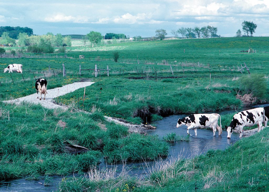
Stream Fencing
Goard, D. 2006. Fencing. 2. Manhattan, KS: Kansas State University Agricultural Experiment Station and Cooperative Extension Service. https://www.kansasforests.org/streamside_forestry/streamside_docs/Fencing.pdf.
In this Kansas State University extension bulletin, Goard describes why fencing is used to exclude livestock and cattle from riparian buffer strips. outlines the problems with unrestricted grazing in riparian areas, and explains how excluding grazing from these areas can be beneficial. Goard goes on to summarize how to implement fencing along riparian corridors.
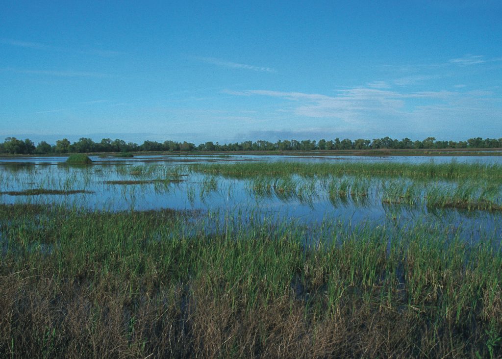
Wetland Conservation

Dahl, T. E., and G. J. Allord. 1996. History of wetlands in the conterminous United States. In National Water Summary on Wetland Resources, ed. J. D. Fretwell, J. S. Williams, and P. J. Redman. USGS Water-Supply. https://www.fws.gov/wetlands/Documents/History-of-Wetlands-in-the-Conterminous-United-States.pdf.
Dah and Allord summarize the history of wetlands in the US dating back to the colonial period. The periods include the colonial period (1600s to 1800s); westward expansion (1800-1860); agriculture moves west (1860-1900); technology changing (1900-1950); and changing priorities and values (1950-present). In all but the last period, wetland loss was widespread, and in some cases, incentivized by the government. For each period, Dahl and Allord describe how wetlands were destroyed and why they were destroyed. For the most recent period, Dahl and Allord describe how the values and ecological services provided by wetlands began to be recognized, resulting in greater perceived value by the public and state and federal legal protection of wetlands. The URL leads to a direct download of a PDF.
Sucik, M., and E. Marks. 2014. The Status and Recent Trends of Wetlands in the United States. 25. Ames, Iowa: US Department of Agriculture Natural Resources Conservation Service. https://www.nrcs.usda.gov/wps/portal/nrcs/main/national/technical/nra/nri/.
This National Resources Inventory report on wetlands for 2010 summarizes changes to wetlands in the US. It includes a brief history of wetlands in the US, then summarizes trends in wetland area across different regions. The general trend is that wetland area has decreased over the history of the National Resources Inventory. Case studies from three different regions highlight pressures triggering wetland loss and efforts to prevent or reverse that loss. The report closes with a description of the National Resources Inventory.
US EPA Office of Water. 2019, May 20. Wetland Functions and Values. https://cfpub.epa.gov/watertrain/moduleFrame.cfm?parent_object_id=262.
In this module, the EPA highlights the full scope of the beneficial attributes of wetlands. The module provides a discussion of how wetlands have become appreciated for their role in providing healthy ecosystems, as well as their benefits to our economy through commercial fishing and cleaner water. The module also highlights other services that wetlands provide: among them, sustainability, recreation, and research.
USDA NRCS. 2008a. Chapter 13 Wetland Restoration, Enhancement, or Creation. In Engineering Field Handbook, 150. Washington, D.C.: USDA NRCS. https://directives.sc.egov.usda.gov/OpenNonWebContent.aspx?content=17765.wba.
As stated in the purpose and scope of this chapter, wetland creation, restoration, or enhancement requires a multidisciplinary approach involving soil science, biology, geology, and engineering. Thus, this chapter is an expansion of the Engineering Field Handbook that encompasses the expanded scope of wetland management. This 150-page document includes information on hydrogeomorphic classification of wetlands and wetland processes and characteristics, as well as guidelines for planning, designing, constructing, and managing wetlands.
USDA NRCS. 2008b. Hydrogeomorphic Wetland Classification System: An Overview and Modification to Better Meet the Needs of the Natural Resources Conservation Service. 10. Washington, D.C.: USDA NRCS. https://www.nrcs.usda.gov/Internet/FSE_DOCUMENTS/nrcs143_010784.pdf.
This technical note was issued in 2008 to guide USDA NRCS staff when assessing hydrogeomorphic (HGM) wetlands. It provides an overview of original HGM concepts and supplies additional structure to the classification system. HGM classification is used in assessing changes to wetlands from proposed projects, wetland improvements, among others. Since its inception in 1993, HGM classification has been solely based on the geographic setting of the wetland in question. However, vegetation and soil properties may more strongly influence wetland function than geography. The USDA NRCS acknowledged this idea in this technical note and subsequently encouraged NRCS staff to include modifiers to original HGM classes to more accurately describe wetland characteristics. The URL leads to a direct download of a PDF.
USDA NRCS. 2015. Chapter 19 Hydrology Tools for Wetland Identification and Analysis. In Engineering Field Handbook, 61. Washington, D.C.: USDA NRCS. https://directives.sc.egov.usda.gov/OpenNonWebContent.aspx?content=37808.wba.
Jurisdictional wetlands require the presence of hydric soils, hydrophytic vegetation, and wetland hydrology. This chapter from the Engineering Field Handbook describes the available tools that use onsite and offsite data to document the presence of wetland hydrology beyond onsite wetland hydrology field indicators. Chapter contents include descriptions of data sources like weather, soils, and streams and how to use that data for hydrologic modeling.
USDA NRCS. 2017. Field Indicators of Hydric Soils in the United States: A Guide for Identifying and Delineating Hydric Soils. (L. M. Vasilas, G. W. Hurt, and J. F. Berkowitz, Eds.) Version 8.0. Washington, D.C.: USDA NRCS in cooperation with the National Technical Committee for Hydric Soils. https://www.nrcs.usda.gov/Internet/FSE_DOCUMENTS/nrcs142p2_053171.pdf.
This technical guide for recognizing hydric soil indicators was developed by the National Technical Committee for Hydric Soils, which includes representatives from USDA NRCS, USFWS, USACE, EPA, academia, and others. It should help staff identify, delineate, and verify hydric soils in the field. It groups and describes indicators as they relate to all soils and then groups and describes indicators specific to soil textures. In addition to field indicators, this guide includes test indicators. The test indicators should not be used to delineate hydric soils but to encourage submission of potential indicator descriptions and supporting data. In this way, the list of approved indicators can be expanded. The URL leads to a direct download of a PDF.
Wetland Creation
Frentress, C., J. C. Cathey, C. D. Mason, T. Parks, R. Hirsch, and M. W. Wagner. 2007. Techniques for Wetland Construction and Management. 23. College Station, TX: Texas A&M University. http://wildlifehabitat.tamu.edu/Lessons/Wetland-Management/Readings/Wetland-Construction-and-Management.pdf.
The objective of this extension publication from Texas A&M is to provide land managers with information on restoring, creating, or enhancing wetlands. The first table summarizes wetland ecosystem services and the functions wetlands perform for that ecosystem. The introduction includes a description of wetland ecosystems, economic benefits from wetlands, and the intrinsic value of wetlands. The authors then present information on wetland construction and management and how wetlands can be managed under different scenarios. The URL leads to a direct download of a PDF.
USDA NRCS. 2010. Wetland Creation. Conservation Practice Standard 658. 4. Washington, D.C.: USDA. https://www.nrcs.usda.gov/Internet/FSE_DOCUMENTS/nrcs143_025863.pdf.
This USDA NRCS conservation practice standard outlines the definition, purpose, conditions, criteria, and considerations of wetland creation. Wetland creation seeks to establish wetland hydrology, vegetation, and wildlife habitats on soils that can support wetland functions. This practice does not apply to areas used to treat water resource pollution, areas of wetland rehabilitation, or wildlife habitat management following wetland establishment. The local hydrology and soils must be suitable to maintain wetland conditions. Native vegetative species should be used to cultivate the wetland. In planning wetland creation, considerations should include how the the proposed wetland could affect the environment in the surrounding area. The URL leads to a direct download of a PDF.
USDA NRCS. 2012. Wetland Creation. Conservation Practice Standard Overview 658 1. Washington, D.C.: USDA. https://www.nrcs.usda.gov/Internet/FSE_DOCUMENTS/stelprdb1255219.pdf.
This USDA NRCS conservation practice standard overview defines wetland creation as establishing a wetland on land that was previously not a wetland. In the practice information section, the purpose of wetland creation should be creating wetland functions and values. The overview closes with a list of associated conservation practices, including dikes, structures for water control, grade stabilization structures, pond sealing and lining, and use exclusion. The URL leads to a direct download of a PDF.
Wetland Enhancement
USDA NRCS. 2010. Wetland Enhancement. Conservation Practice Standard 659. 5. Washington, D.C.: USDA. https://www.nrcs.usda.gov/Internet/FSE_DOCUMENTS/nrcs143_026454.pdf.
This USDA NRCS conservation practice standard outlines the definition, goals, criteria, and considerations in enhancing wetlands. The goal of wetland enhancement is to augment specific wetland functions beyond what naturally occurring conditions allow, sometimes at the expense of other wetland functions, using soil, vegetation, hydrology, and wildlife habitats. This practice does not apply to the treatment of water pollution sources, rehabilitation of wetlands, restoration of a historic wetland, or wetland establishment. The URL leads to a direct download of a PDF.
USDA NRCS. 2012. Wetland Enhancement. Conservation Practice Standard Overview 659. 1. Washington, D.C.: USDA. https://www.nrcs.usda.gov/Internet/FSE_DOCUMENTS/stelprdb1255220.pdf.
This USDA NRCS conservation practice standard overview defines wetland enhancement as modification of an existing wetland or reestablishment of a degraded wetland for the purposes of favoring specific wetland functions. It provides a brief description of where this practice applies and the purposes of this practice. It closes with a list of commonly associated conservation practices, including dikes, structures for water control, fencing, fish passages, and use exclusion. The URL leads to a direct download of a PDF.
Wetland Restoration
USDA NRCS. 2007. Noxious, Invasive, and Alien Plant Species: A Challenge in Wetland Restoration and Enhancement. Technical Note 190-72. 26. Washington, D.C.: USDA NRCS. https://www.nrcs.usda.gov/wps/portal/nrcs/detail/national/water/wetlands/restore/?cid=nrcs143_010912.
The purpose of this technical note is to inform USDA NRCS staff of plant species that prevent successfully restoring and enhancing wetlands. It defines five categories of plants, listed in order of increasing threat: native, alien, weeds, invasive, and noxious. Alien, weeds, invasive, and noxious species displace native vegetation and thus interfere with wetland enhancement and restoration, reducing biodiversity, reducing wildlife habitat and food resources, and disrupting ecosystem processes. This technical note includes a list of common invasive and noxious plant species that impair wetland enhancement and restoration and describes their dispersal methods and control practices. Mitigating the spread of such species requires familiarity with potential threats in an area, anticipating sources of harmful plant species, developing monitoring protocols, and encouraging establishment of native species in disturbed areas.
USDA NRCS. 2008. Stream Water Surface Profile Modification for Wetland Restoration. Technical Note 1. 25. Washington, D.C.: USDA NRCS. https://www.nrcs.usda.gov/wps/PA_NRCSConsumption/download?cid=stelprdb1243051&ext=pdf.
This technical note from the USDA NRCS applies to riverine wetlands in which the wetland hydrology has changed due to incision of the stream channel and is used for developing strategies for restoring or enhancing the connectivity between the floodplain and the stream. The technical note begins with background information for classifying or describing wetlands and stream channels, including hydrogeomorphic wetland classification, landscape position, hydrology, and stream channel classification. Then, wetland restoration or enhancement and hydrology restoration strategies are described in detail, including design conditions for various scenarios, as well as guidelines for modeling hydrology for such conditions.
USDA NRCS. 2010. Wetland Restoration. Conservation Practice Standard 657. 5. Washington, D.C.: USDA. https://www.nrcs.usda.gov/Internet/FSE_DOCUMENTS/nrcs143_026340.pdf.
This USDA NRCS conservation practice standard defines wetland restoration as the return of a wetland and its functions to an approximation of its conditions before disturbance. Restoration restores site conditions favorable for hydric soil properties, wetland hydrology, native hydrophytic vegetation, and native wildlife habitats. Wetland restoration does not include treating water resource pollution areas, wetland rehabilitation where enhancements have been made to certain functions, wetland creation, or wildlife habitat management. The practice standard provides the criteria, recommendations, and considerations for restoring hydric soil properties, wetland hydrology, hydrophytic vegetation, and wildlife habitats. It also recommends maintenance following restoration for such things as pests, sediment load, and invasive species.
USDA NRCS. 2011. Scenarios for Wetland Restoration. Technical Note 4. 33. Washington, D.C.: USDA NRCS. https://www.nrcs.usda.gov/wps/PA_NRCSConsumption/download?cid=stelprdb1243054&ext=pdf.
This USDA NRCS technical note provides general principles for wetland restoration as described in Conservation Practice Standard 657. These principles are presented in the context of nine different scenarios based on hydrogeomorphic wetland classification, hydrology, and topography.
USDA NRCS. 2012. Wetland Restoration. Conservation Practice Standard Overview 657. 1. Washington, D.C.: USDA. https://www.nrcs.usda.gov/Internet/FSE_DOCUMENTS/stelprdb1255218.pdf.
This conservation practice standard overview defines wetland restoration as returning a wetland and its functions to an approximation of its conditions before disturbance. The goals of wetland restoration and considerations for the practice are briefly described. The overview concludes with a list of associated conservation practices, including dikes, structures for water control, habitat management, riparian herbaceous cover, and riparian forest buffer.
Wetland Wildlife Habitat Management
USDA NRCS. 2012a. Wetland Wildlife Habitat Management. Conservation Practice Standard 644. 2. Washington, D.C.: USDA. https://www.nrcs.usda.gov/Internet/FSE_DOCUMENTS/nrcs143_026455.pdf.
This USDA NRCS conservation practice standard defines wetland wildlife habitat management as retaining, managing, or developing wetland habitat for wetland wildlife. The standard further describes the purpose as to improve, develop, or maintain wetland habitat for waterfowl, shorebirds, fur-bearers, or other fauna and flora associated with wetlands. Conditions where the conservation practice applies and criteria for the practice are described, followed by considerations, plans and specifications, and operation and maintenance of the conservation practice. The URL leads to a direct download of a PDF.
USDA NRCS. 2012b. Wetland Wildlife Habitat Management. Conservation Practice Standard Overview 644. 1. Washington, D.C.: USDA. https://www.nrcs.usda.gov/Internet/FSE_DOCUMENTS/stelprdb1255211.pdf.
This USDA NRCS conservation practice standard overview defines wetland wildlife habitat management as retaining, managing, or developing wetland habitat for wetland wildlife. The standard further describes the purpose as to improve, develop, or maintain wetland habitat for waterfowl, shorebirds, fur-bearers, or other fauna and flora associated with wetlands. Conditions where the conservation practice applies and other considerations for implementing the practice are briefly described. It concludes with a list of associated conservation practices, including wetland restoration, wetland enhancement, restoration and management of rare and declining habitats, shallow development and management, and upland wildlife habitat management, among others. The URL leads to a direct download of a PDF.